Search
NEON Biorepository Sample Portal at Arizona State University
Find data on archived physical samples and information on how to request a loan from the Biorepository, our primary sample and specimen collection.
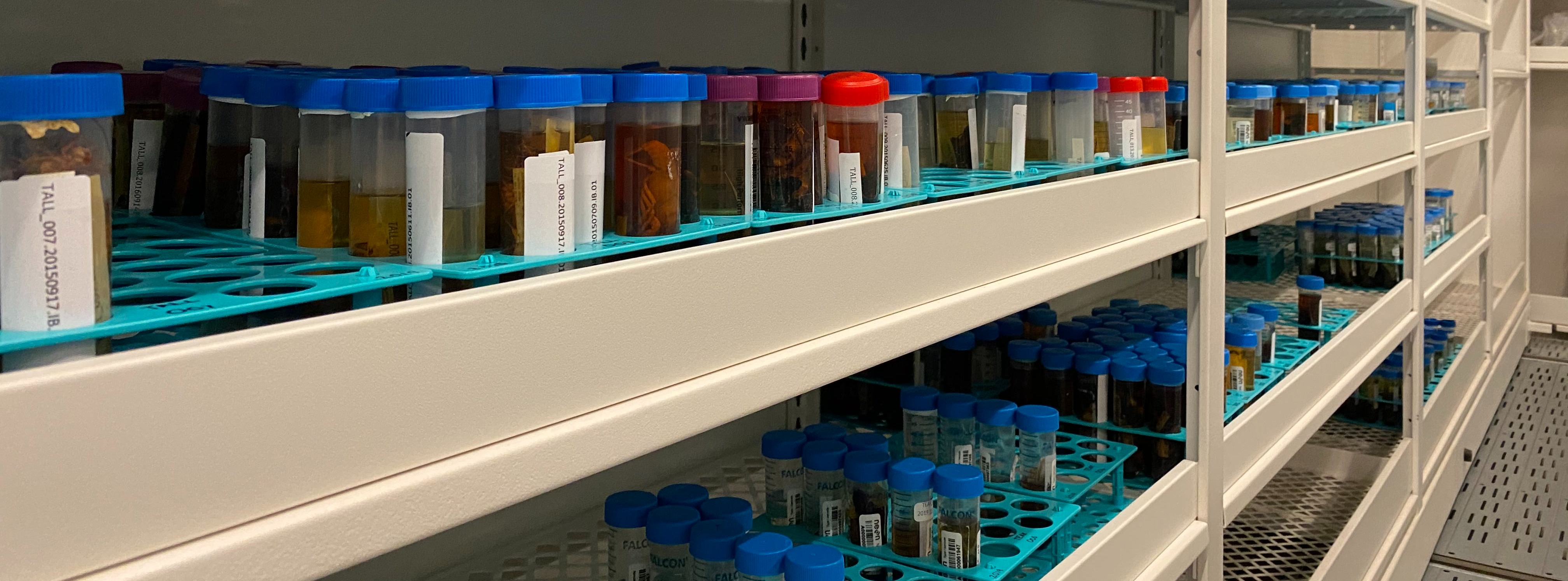
Each year, NEON collects and archives over 100,000 biological, genomic, and geological samples and specimens per year from terrestrial and aquatic sites. These samples and specimens complement the field observations and automated measurements collected at field sites. They represent a rich resource unique among natural history collections due to NEON’s scope for continental- and decadal-scale ecology. NEON’s archived samples are available upon request to support research studies and analyses. Samples are archived in a variety of collections around the country though the majority of samples are curated at the NEON Biorepository, managed by the Biodiversity Knowledge Integration Center (BioKIC) and Arizona State University’s Natural History Collections in Tempe, Arizona.
A new NSF DCL presents an opportunity to leverage the NEON Biorepository collections. Please contact us with any questions or for information needed for potential innovative use! We are here to support you.

About Samples
Learn about the types of samples NEON collects, and how they are processed, organized and labeled.

Search for Samples
All of NEON's samples can be requested for loan. Explore all of our available specimens and samples.

Sample Services
Interested in requesting samples or storing your samples with the Biorepository? Request forms are available here.

Guidelines & Policies
Explore our sample usage policies and recommendations for acknowledging and citing NEON sample use, along with guidance on publishing your own datasets.

Species Checklists
Vouchered species lists from all NEON sites and domains, along with taxonomic checklists with keys used for species identification.

Sample Analysis
Discover tools for analyzing samples, such as the Biorepository API and the Sample Explorer, to investigate sample connections and custody history.
Statistics
2,994 species
453,059 samples
41,316 images
9 years
16 sample types
66 sites
Explore Samples by Location
Site | Type | Terrain | Domain | State | Coordinates |
|---|---|---|---|---|---|
| | | | | |
| Gradient | Terrestrial | 45.76244 -122.33032 | |||
| Core | Aquatic | 39.75821 -102.44715 | |||
| Gradient | Terrestrial | 44.06389 -71.28737 | |||
| Gradient | Aquatic | 32.54153 -87.79815 | |||
| Core | Aquatic | 44.95011 -110.58715 | |||
| Gradient | Terrestrial | 39.03370 -78.04179 | |||
| Gradient | Aquatic | 34.44422 -96.62420 | |||
| Core | Aquatic | 65.15322 -147.50397 | |||
| Core | Terrestrial | 65.15401 -147.50258 | |||
| Core | Terrestrial | 40.81554 -104.74559 | |||
| Core | Terrestrial | 47.12820 -99.24133 | |||
| Core | Aquatic | 40.03496 -105.54416 | |||
| Core | Aquatic | 46.20967 -89.47369 | |||
| Gradient | Terrestrial | 47.16165 -99.10656 | |||
| Gradient | Terrestrial | 32.54173 -87.80388 | |||
| Gradient | Terrestrial | 63.88112 -145.75136 | |||
| Gradient | Terrestrial | 28.12505 -81.43619 | |||
| Gradient | Aquatic | 31.18542 -84.43740 | |||
| Gradient | Terrestrial | 35.68896 -83.50195 | |||
| Core | Terrestrial | 17.96955 -66.86870 | |||
| Core | Terrestrial | 42.53691 -72.17265 | |||
| Gradient | Terrestrial | 63.87580 -149.21335 | |||
| Gradient | Terrestrial | 32.59069 -106.84254 | |||
| Gradient | Terrestrial | 39.04043 -95.19215 | |||
| Core | Aquatic | 39.10506 -96.60383 | |||
| Gradient | Terrestrial | 39.11045 -96.61293 | |||
| Core | Terrestrial | 39.10077 -96.56307 | |||
| Gradient | Terrestrial | 18.02126 -67.07689 | |||
| Core | Aquatic | 29.67598 -82.00841 | |||
| Core | Aquatic | 29.68778 -82.01775 | |||
| Gradient | Aquatic | 35.69043 -83.50379 | |||
| Gradient | Terrestrial | 31.85386 -88.16118 | |||
| Gradient | Aquatic | 39.09564 -77.98322 | |||
| Gradient | Aquatic | 45.99827 -89.70477 | |||
| Core | Aquatic | 42.47194 -72.32953 | |||
| Gradient | Terrestrial | 37.00583 -119.00602 | |||
| Gradient | Aquatic | 31.85343 -88.15887 | |||
| Core | Terrestrial | 33.40123 -97.57000 | |||
| Core | Aquatic | 45.79084 -121.93379 | |||
| Gradient | Terrestrial | 35.41060 -99.05878 | |||
| Core | Aquatic | 32.96037 -87.40769 | |||
| Gradient | Aquatic | 38.94586 -96.44302 | |||
| Gradient | Aquatic | 44.25960 -122.16555 | |||
| Gradient | Terrestrial | 38.24828 -109.38827 | |||
| Gradient | Terrestrial | 37.37831 -80.52485 | |||
| Core | Terrestrial | 40.05425 -105.58237 | |||
| Gradient | Terrestrial | 40.46189 -103.02929 | |||
| Gradient | Terrestrial | 46.76972 -100.91535 | |||
| Core | Terrestrial | 35.96413 -84.28259 | |||
| Core | Aquatic | 68.66975 -149.14302 | |||
| Core | Terrestrial | 40.17760 -112.45245 | |||
| Core | Terrestrial | 29.68928 -81.99343 | |||
| Core | Aquatic | 38.89431 -78.14726 | |||
| Gradient | Aquatic | 47.15909 -99.11388 | |||
| Core | Aquatic | 47.12984 -99.25315 | |||
| Core | Aquatic | 33.37852 -97.78231 | |||
| Core | Terrestrial | 19.55309 -155.31731 | |||
| Core | Aquatic | 40.78393 -111.79789 | |||
| Core | Aquatic | 18.11352 -66.98676 | |||
| Gradient | Aquatic | 18.17406 -66.79868 | |||
| Gradient | Terrestrial | 40.27590 -105.54596 | |||
| Core | Terrestrial | 37.10878 -119.73228 | |||
| Core | Terrestrial | 31.91068 -110.83549 | |||
| Core | Terrestrial | 38.89292 -78.13949 | |||
| Gradient | Terrestrial | 38.89013 -76.56001 | |||
| Gradient | Terrestrial | 37.03337 -119.26219 | |||
| Gradient | Terrestrial | 45.50894 -89.58637 | |||
| Core | Aquatic | 33.75099 -111.50809 | |||
| Core | Terrestrial | 32.95047 -87.39326 | |||
| Core | Aquatic | 36.95593 -119.02736 | |||
| Gradient | Terrestrial | 31.19484 -84.46862 | |||
| Core | Terrestrial | 68.66109 -149.37047 | |||
| Gradient | Aquatic | 68.63069 -149.61064 | |||
| Gradient | Terrestrial | 45.49369 -89.58571 | |||
| Core | Terrestrial | 46.23391 -89.53725 | |||
| Gradient | Aquatic | 37.05972 -119.25755 | |||
| Gradient | Terrestrial | 71.28241 -156.61936 | |||
| Core | Aquatic | 35.95738 -84.27925 | |||
| Gradient | Aquatic | 39.89137 -105.91540 | |||
| Core | Terrestrial | 45.82049 -121.95191 | |||
| Core | Terrestrial | 44.95348 -110.53914 |